UN
9 Rankin Close
£ 322,500
Description
We don't have a Description for this property.
- Bedrooms
- 2
- Bathrooms
- 0
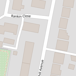


Leaflet © OpenStreetMap contributors
The heatmap indicates the level of crime in the area. The color of the heatmap indicates the crime severity and recency.
Metrics Year-on-Year
- Average area value
- 458,118.00 £Increased by 1.52 %
- Average area rental value
- 2,280.00 £/moIncreased by 20.44 %
- Est rental Yield
- 5.97 %Increased by 18.69 %
- Crime Rate
- 2.00 %Unchanged by 0.00 %
from 451,272.00 £
from 1,893.00 £/mo
from 5.03 %
from 2.00 %
Nearby Schools
| Name | Type | Ofsted | Distance |
|---|---|---|---|
| Colindale Primary School | Community School | Good | 0.51 KM |
| Saracens High School | Free Schools | 0.83 KM | |
| North London Grammar School | Other Independent School | Outstanding | 0.87 KM |
| First Rung Independent School | Other Independent School | Good | 0.91 KM |
| Wingfield And Stonegrove Children'S Centre | Children's Centre | 0.97 KM |
Images
Nearby Streets
| Name | Average Price | Average Sqft | Distance |
|---|---|---|---|
| Aerial Square | £ 0 | 0 | 0.00 KM |
| Bute Close | £ 600,000 | 0 | 0.00 KM |
| Colindale Gardens | £ 0 | 0 | 0.00 KM |
| Lismore Boulevard | £ 375,000 | 0 | 0.00 KM |
| The Loning | £ 535,000 | 1,596 | 0.00 KM |
Nearby Transport
| Name | NLC | TLC | Distance |
|---|---|---|---|
| Hendon | 1522 | HEN | 1.80 KM |
| Mill Hill Broadway | 1527 | MIL | 2.22 KM |
| Cricklewood | 1519 | CRI | 5.51 KM |
| Wembley Stadium | 1509 | WCX | 5.97 KM |
| Stonebridge Park | 1454 | SBP | 6.25 KM |
Nearby Listings
| Address | Price | Type | Score | Distance |
|---|---|---|---|---|
| Sheaveshill Avenue, London, NW9 | £ 600,000 | BUY | 6 / 10 | 0.07 KM |
| Sheaveshill Avenue, Colindale, London, NW9 | £ 600,000 | BUY | 7 / 10 | 0.11 KM |
| Chronicle Avenue, London | £ 450,000 | BUY | 6 / 10 | 0.13 KM |
| Ledger Court, Chronicle Avenue, NW9 | £ 500,000 | BUY | 7 / 10 | 0.17 KM |
| Sanday Drive, Darmera House, NW9 | £ 350,000 | BUY | 6 / 10 | 0.17 KM |
Nearby Properties
| Address | Price | Distance |
|---|---|---|
| 22 Rankin Close | £ 450,000 | 0.00 KM |
| 12 Rankin Close | £ 335,000 | 0.00 KM |
| 29 Rankin Close | £ 470,000 | 0.00 KM |
| 18 Rankin Close | £ 270,000 | 0.00 KM |
| 14 Rankin Close | £ 125,000 | 0.00 KM |